Skip to Content
Open Menu
Close Menu
Home
About Us
Kristen’s Story
Our Mission/About Us
Meet Our Team
Resources
Mental Health Resources & Scholarships (THE HUB)
Request Support & Scholarships
Join the Resource Network (Providers)
Workshops & Courses
Online Support Groups
Partner Organizations & Discounts
Media
Blogs
Videos and More
Ride Out of the Darkness
Upcoming Events
Light Therapy Sessions
Light Therapy Sessions
PandoraStar Light Therapy
Infrared Light Healing Cocoon
Sound Therapy
Become a Partner
Volunteer
Social Media
Contact
Our Store
(
0
)
Cart
(
0
)
Donate
Open Menu
Close Menu
Home
Folder:
About Us
Back
Kristen’s Story
Our Mission/About Us
Meet Our Team
Folder:
Resources
Back
Mental Health Resources & Scholarships (THE HUB)
Request Support & Scholarships
Join the Resource Network (Providers)
Workshops & Courses
Online Support Groups
Partner Organizations & Discounts
Folder:
Media
Back
Blogs
Videos and More
Ride Out of the Darkness
Upcoming Events
Folder:
Light Therapy Sessions
Back
Light Therapy Sessions
PandoraStar Light Therapy
Infrared Light Healing Cocoon
Sound Therapy
Become a Partner
Volunteer
Social Media
Contact
Our Store
Donate
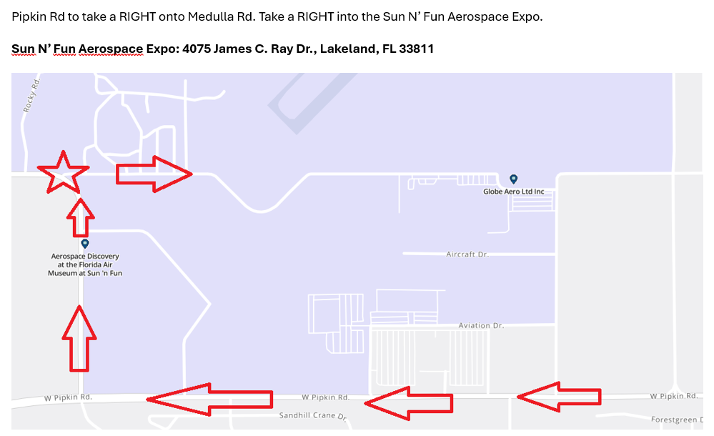
2025 Route Map: Click Here